
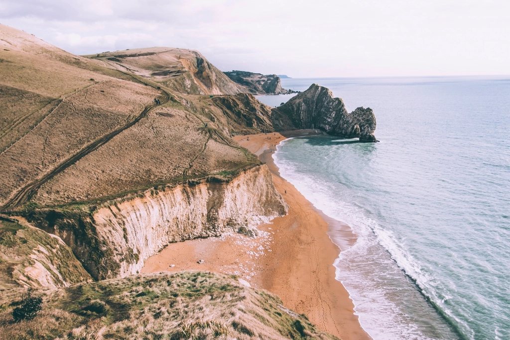
Between Porlock and Lynmouth the coast of Exmoor does something unusual for England: it goes up. The hills come straight down to the sea in wooded slopes so steep that there is no road, no village and hardly a house for miles, and the path that picks its way along them is graded as severe by the people who look after it. It is not the highest stretch of the South West Coast Path, and there are harder days further west, but for sustained climbing and descending in deep woodland, with the Bristol Channel glinting far below through the oaks, there is nothing else quite like it. It can be walked as a single long day from Porlock, with recovery in Lynmouth. Here is how the day goes.
The shape of the day
From Porlock village the path crosses the marsh to Porlock Weir, about a mile and a half (2.5 km) of flat walking, and from the Weir to Lynmouth the official coast path distance is a little over 12 miles (19.5 km). Call it 14 miles (22 km) door to door. The distance is unremarkable; the profile is not. The path climbs to around 1,000 ft (300 m) more than once and drops most of the way back down in between, and by the end the total ascent is well over 2,000 ft (600 m). Guidebooks suggest seven to eight hours of walking. Nine hours with lunch is a safer allowance.
Because of all this, start early, ideally by half past eight, and avoid the short days of midwinter unless the weather is certain. In summer the woods give welcome shade for most of the day, which is another reason to prefer this direction: the exposed grassy final stretch above Lynmouth comes in the late afternoon, when the sun is lower.
Porlock Weir and the drowned marsh
Porlock sits in a bowl of hills with the coast road climbing out of it at a gradient of one in four, which is why coaches used to stop at the bottom and visitors walked. The marsh between the village and the sea was a freshwater grazing meadow until a storm in 1996 breached the shingle ridge that protected it; the sea was allowed in and the fields have become salt marsh, with dead trees standing white in the mud and a great deal of birdlife. The path runs along the ridge itself, on loose pebbles that are surprisingly tiring, before reaching the tiny harbour at the Weir, with its old cottages and its lime kilns. It is the last place to buy anything until Lynmouth.
Culbone and the miles without a road
The climb out of Porlock Weir goes through a stone arch and straight up into the trees, and within twenty minutes you have left the world of cars behind. About two miles (3 km) on, in a fold of the hillside, stands Culbone church, which is generally reckoned the smallest complete parish church in England, barely 35 ft (11 m) long inside, with a little slate spire and a graveyard full of ferns. It is reached only on foot. Services are still held here, and the silence when you sit in the porch is total apart from the stream.
Beyond Culbone the path settles into its rhythm: long traverses through sessile oak woods that were once coppiced for charcoal, occasional glimpses of the sea a few hundred feet below, and short, sharp descents into combes where a stream falls to the shore, followed by equally sharp climbs out. Parts of this hillside are unstable and the route has been moved inland several times after landslips, so the waymarks, not the map, should be trusted where they disagree. Somewhere in the middle of this stretch the path crosses from Somerset into Devon, and the county boundary is marked by a stone by a spring where, according to a local story, a saint once refreshed himself. It is a good place for lunch.
Foreland Point and the descent to Lynmouth
Eventually the woods thin and the path comes out onto open bracken and heather above the sea, with the great whaleback of Foreland Point ahead. This is the most northerly point of Devon, with a lighthouse tucked beneath it that has warned shipping off the rocks since 1900. The main route cuts across the neck of the headland to the little church at Countisbury, but the walk out around the point itself, on a narrow path with the sea straight below, is the finest mile of the day if you have the legs and the weather for it.
From Countisbury the path drops steeply, and then more steeply, down the flank of the hill to Lynmouth, with the twin villages laid out below: Lynmouth on the shore at the meeting of two rivers, Lynton on the cliff five hundred feet above it. The two are linked by a water-powered cliff railway that has run since 1890 and remains the most sensible way to get up to bed at the end of this particular day. Lynmouth itself was rebuilt after a catastrophic flood in August 1952, when the rivers rose in a single night and swept much of the village away, and the memorial hall on the front tells the story with restraint.
Getting there, getting back, and where to sleep
Public transport works, with planning. Porlock has a year-round bus from Minehead, itself the end of a steam railway line from the main network, and in summer an open-top coastal bus runs between Minehead, Porlock and Lynmouth, which makes a linear walk simple: leave the car in Minehead or come by train, sleep in Porlock, walk, sleep in Lynmouth, ride back. Out of season the link between Lynmouth and the rest of the world is thinner, and some Porlock accommodation providers may arrange collection at the far end for a fee, which is worth asking about when you book.
- Carry at least two litres of water each; there is nothing to buy between Porlock Weir and Lynmouth.
- Poles help enormously on the descents, which are the part that hurts.
- Check the official diversion notices for the coast path before you set out; landslips are common after wet winters.
- Book Lynmouth early in summer; rooms are few and the villages fill up.
Walkers who want more can carry on west the next day, over the Valley of Rocks and along the cliffs to Combe Martin past the highest sea cliff in England. Many walkers prefer to take the cliff railway up, eat well and rest instead.